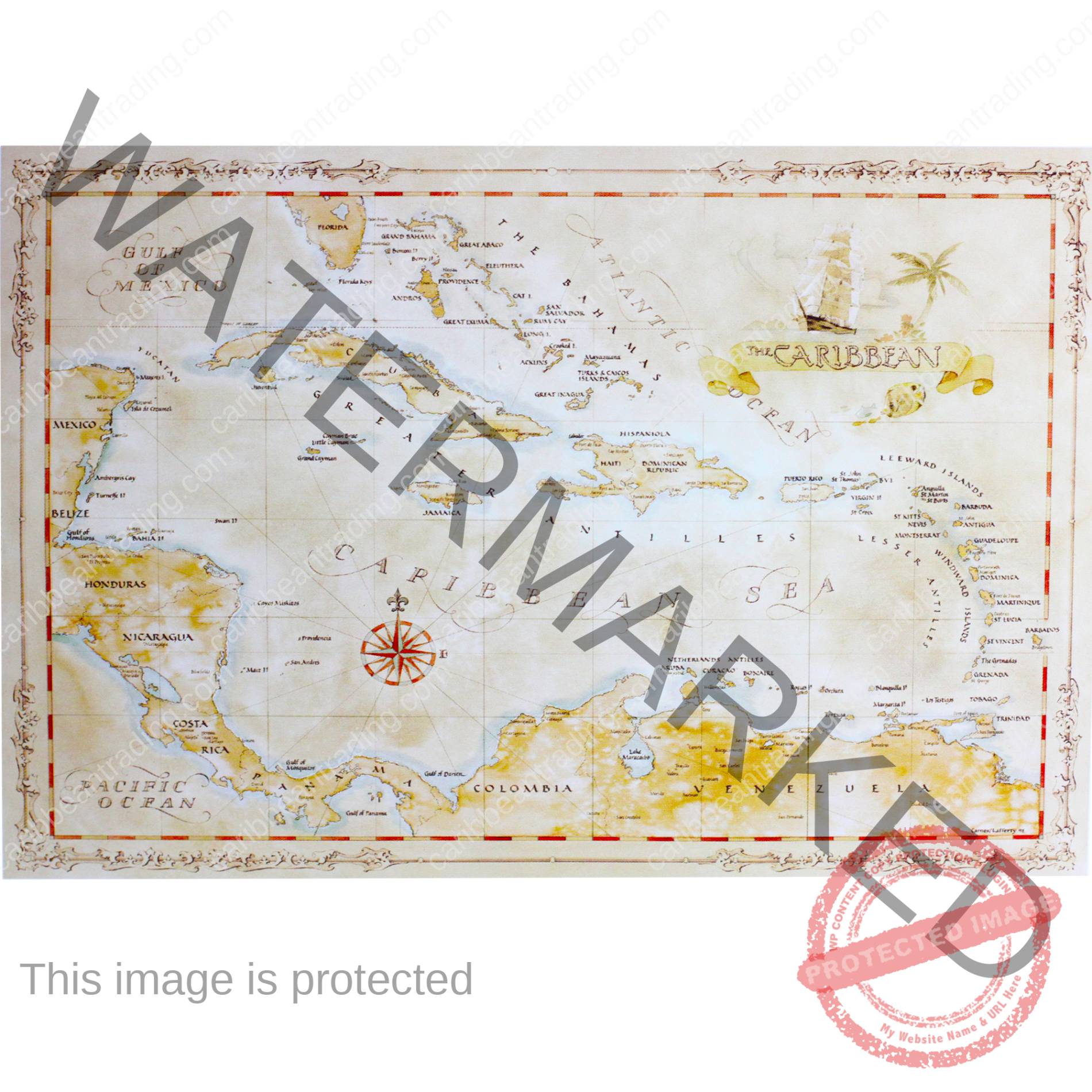
Antiqued Caribbean Map – Large
$26.00
In stock
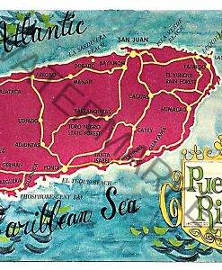
This Antiqued Caribbean map is a nice quality print of antique style maps and charts, capturing an old world style but offering current geographical information. These maps are taken from original watercolor paintings. They are meticulously printed on quality parchment paper. The maps are excellent references and frame beautifully, enhancing the most discerning décor. The maps are printed on heavy, quality parchment paper.
I do lots of traveling around the Caribbean and always have my eyes open for nice gifts. We first saw these maps in Jamaica and had to get some for myself. They are very nice quality.
Size:29″ x 22″
Maps are a long-time favorite of the Caribbean Trading Company! Maps not only place things geographically and locationally, but they also show the history of knowledge, and also what was important to people at the time. (or at least who was powerful at the time). It power lies in its visual nature – in a quick glance you can easily understand it.
Head on over to our blog for some more Map history and fun!
Or visit the Smithsonian for an excellent overview of the history of maps through the ages:
| Weight | 25 oz |
|---|---|
| Dimensions | 20 × 5 × 5 in |
Be the first to review “Antiqued Caribbean Map – Large” Cancel reply
You must be logged in to post a review.
Related products
Dress
Dress
children
Dog Bandana
Food & Gourmet
Food & Gourmet
Related Posts
Must-Visit Caribbean Art Galleries
The Caribbean is not only known for its breathtaking beaches, crystal-clear waters, and vibrant music but also for its rich artistic heritage. The region’s art galleries are a testament to the islands’ diverse cultures, histories, and natural beauty. From traditional ...
Read MoreSkincare Tips for Dealing with Humidity in the Caribbean
Living or vacationing in the Caribbean means immersing yourself in warm breezes, turquoise waters, and vibrant culture. However, one challenge that comes with this tropical paradise is the ever-present humidity. The high moisture in the air can lead to clogged ...
Read MoreFamous Caribbean Cocktail Bars You Must Visit
The Caribbean isn’t just about turquoise waters and white sand beaches. It’s also a top destination for cocktail lovers. The islands are bursting with vibrant bars where mixologists serve up tropical creations that blend local spirits, fresh fruits, and island ...
Read More









Reviews
There are no reviews yet.